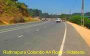
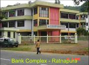
Ratnapura Town, the capital of Sabaragamuwa Province is located 101 kilometers away from Colombo on the Colombo-Badulla main road as an important intermediary center, with direct linkages in between Uva Province, Southern Province and Central Province. According to 2001 Population and Housing Census, Ratnapura Municipal Council area had a total population of 46,309 and it was projected to 47,811 by the year 2004. It is located above an elevation of 18 meters MSL (mean sea level) with in a basin of Western part of the central hills having a significant environmental impact. Ancient, Ratnapura was known as “Saparapura”. Due to its prominent location, it was evolved into a commercial town. Until the period of the last Sinhala king, Ratnapura was the capital of the Sabaragamuwa region. In 1887 a Local Board was established for the administration and maintenance of the town. In 1922 under the Local Government Ordinance this town has been brought under the Local Government Board and gradually promoted, into a municipal council in 1968.
Location, Topography and Climatic Features
Ratnapura Municipal Council area, is 22.2 square kilometers in extent, and located in- between the northern latitude of 6 degrees-41’ to 6’ degrees 42” and eastern longitudes of 80 degrees -23’ to 80 degrees -24’. Ratnapura Divisional Secretariat is located within this town. According to the topographic features, the town contain of mountains with steep slopes, rivers, river valleys, low lying lands and plains. It is situated at a range of 18 to 305 meters above MSL. Kalu Ganga and the We Ganga confluence in the Ratnapura town, these important physical features should be considered in the preparation of the urban development plan. About 13% of the urban area low lying land (Paddy lands is under and marshy lands) which plays an important role in retaining excess water during floods. Geologically the town consists of Pre-Cambrain Highlands Series and stones coming under Charnockite variety. Gem deposits are found along the low lying strata. As the town is situated within a basin area, it experiences an average annual temperature of 29.44o centigrade. The maximum temperature is recorded in the month of March whilst the lowest is in the month of January. The annual average rainfall in the town varies in-between 3,000 to 4,000 millimeters. The highest rainfall is experienced during the south west monsoon in May and June and in the inter-monsoon of September and October.
Development Concept
Ratnapura Urban Development Area (Ratnapura Municipal Council Area) is an urban area that has been planned based on the Growth Center Concept. Accordingly, zoning, development proposals, proposed infrastructure facilities, and planning and building regulations have been prepared in keeping with the Growth Center Concept.
Regional Setting
The region consists of diverse topographic features like mountain ranges, mountain tops, rivers and river valleys and plains. It has an elevation ranging from 18 to 2140 meters above MSL. When the region is taken as a whole, north east contain of mountain areas and the south west is of a slightly undulated plain. Kelani, Walawe and Kalu ganga are the main rivers that flow through the region. The region is rich with natural resources such as gem, graphite, calcium, dolomite, lime stones and clay, Rivers and beautiful waterfalls, natural forests like Sinha Raja forest and the environmentally amiable forest parks like Uda Walawe forest park. Out of the total land area, 24.5% is come under plantation, 19.5% under home gardens and 15.5% under forests. Land uses for urban housing are as low as 0.1%. The urban population ratio is very much lesser than the national average. In 1981 it was 7.43 % in Ratnapura District and 7.7% in Kegalle District. The population distribution in 2001 is classified as 5.8% urban population, 84.1 % rural population and 10.1% estate population. Within the region only Ratnapura town has a population exceeding 40,000. Kegalle town is ranked as the second. Although Ratnapura is not officially recognized as a developed area there are 95 urban and service centers within this region. (Map No.1 indicate this position) There has been a tendency for rural population to settle down in an area closer to the main roads and in flat lands. The settlements in plantations are more complex than the rural settlements. Very often they are congested. The national per capita income in 1991 was Rs.708. But in this region it was as low as Rs.517. In 1997 the Samurdhi beneficiary families in the region were 61.0%. In comparison with the national figure of 52.0% of Samurdhi beneficiary families, this region shows a higher dependency rate.
Development Area's
Old Town (Commercial Center) Ratnapura old town area is already a developed commercial center. Still it has an increasing demand for commercial activities. This area could be further developed by providing necessary facilities.
New Town (Administrative Center)
Around 90 percent of the administrative institutions that were in the old town have already been relocated in the new town. Essential infrastructure facilities have been already developed to shift the administrative centers, which are still remaining in the old town, and also to accommodate the new administrative institutions that could be established. The relevant residential facilities for these administrative institutions will also be developed.
Kuruwita Area (Industrial and Residential Centers)
At present Kuruwita area is not coming within the purview of the Ratnapura Municipal Council area. However, under the urban area expansion scheme that the Ratnapura Municipal Council area is proposed to be expanded to include Kuruwita area. Already, actions have been initiated in Kuruwita area, to develop facilities required for industrial development. The existing Paradise Industrial Town situated within Kuruwita area is contributing to achieve this target. Further, facilities needed for residential purposes too are being improved in this area.

